The old gothic Church of St. Mary the Crowned and St. Bernard

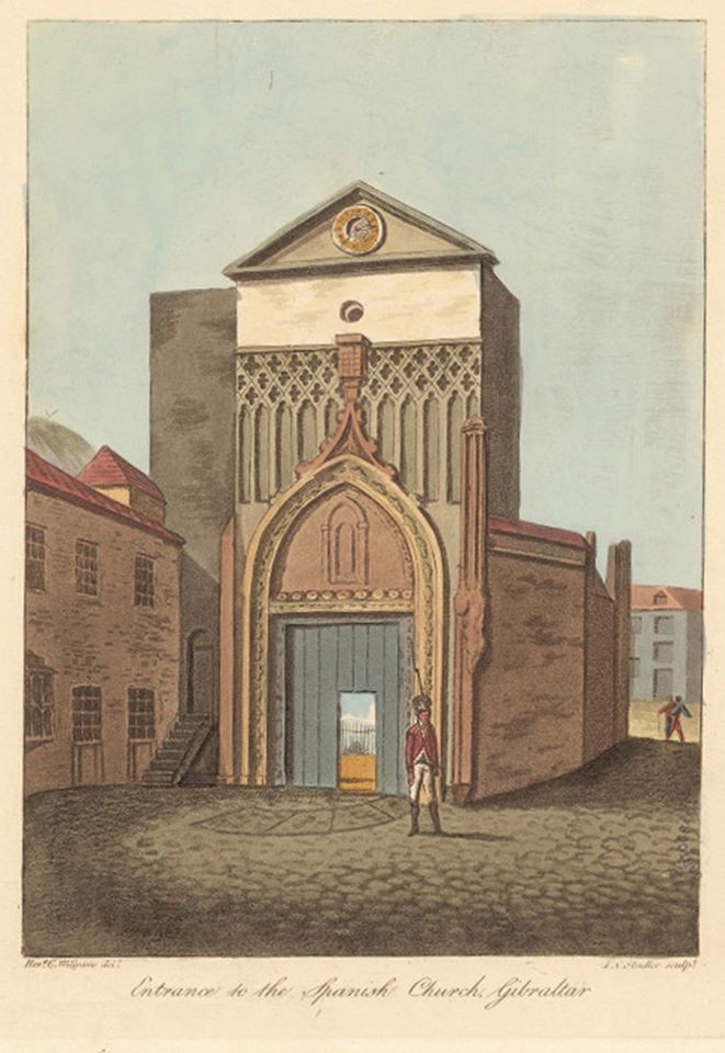
Entrance to what was once the old mosque courtyard and later formed part of the gothic church from the early 16th century (Cooper Willyams, 1801)
The old gothic Church of St. Mary the Crowned and St. Bernard
Taking advantage of the works being carried out in order to pedestrianize Main Street in the 1990s, the Gibraltar National Museum carried out a series of archaeological interventions, yielding very interesting data on the history of Gibraltar.
We already knew about the construction of a church in 1502, upon an existing mosque, by the Catholic Monarchs when the city was ceded to the Spanish crown, through the written accounts of Alonso Hernández de Portillo. The church suffered great damage during the Great Siege (1779-83) and in 1810 the gothic façade was demolished and the construction of the current façade began. This was built a few metres to the east in order to widen this part of Main Street.
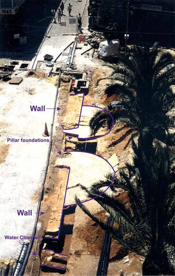
During the excavations, a wall measuring 15m in length and 1.2m wide, running north to south was recorded. It was built using even-sized blocks of limestone and sandstone with flat exterior surfaces and joined using a lime and red clay mortar. A 1.5m wide entrance was discovered in the central area. The wall could be dated to the 14th century during Gibraltar’s Marinid period. By the 16th century a large entrance had been opened in the central part of the wall, flanked by two very large semi-circular foundation structures abutting the wall. These have been interpreted as the bases of the entrance portico to the early church and built in a late-gothic style as commissioned by the Catholic Monarchs.
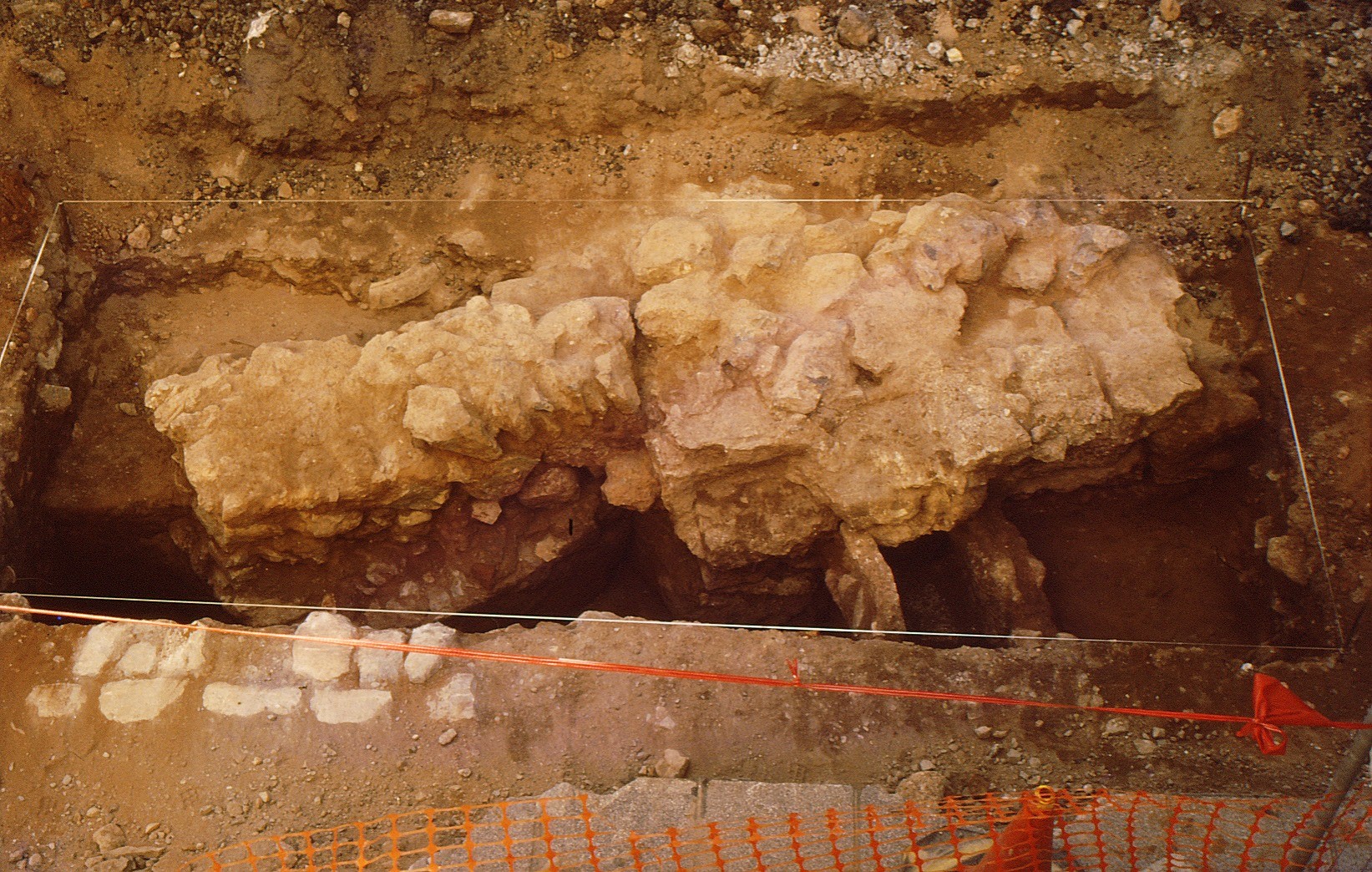
Another recorded structure was a water channel, running east to west, drawing water into the building. This channel was from the Marinid period or even earlier and could relate to the water supply system for the ablutions courtyard (‘sahn’ in Arabic) or ‘Patio de los Naranjos’ (orange grove). In Castilian times, this courtyard would have still been adjacent to the church. A few metres south we also recorded a wall and another water channel, likely belonging to the perimeter enclosure of the ablutions courtyard of the old mosque.
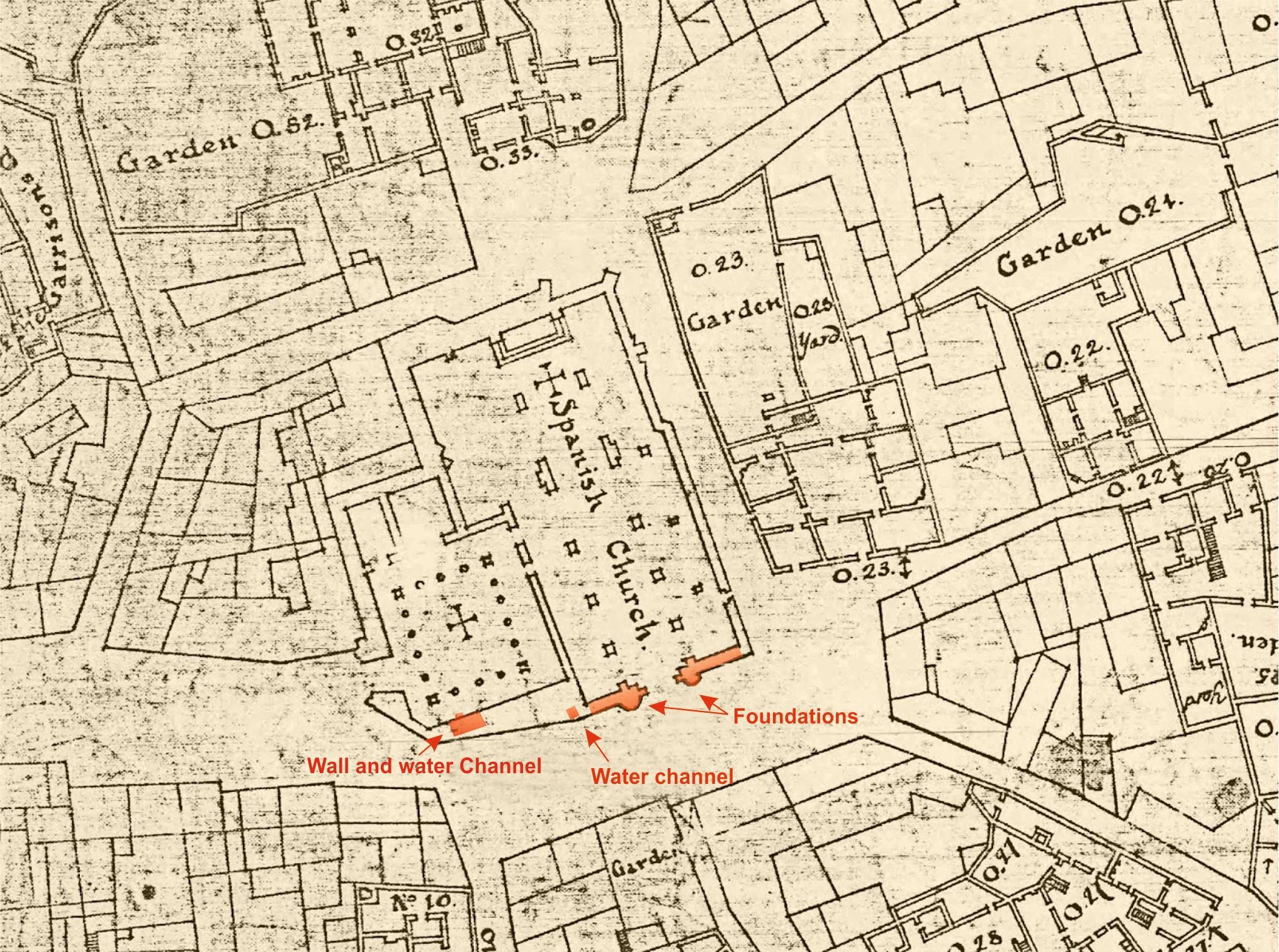
We knew about the church’s construction over an existing mosque which was located in the area of the city known as ‘Turba al-Hamra’ (or red mound, in reference to the red sands) and the mosque could be dated to the period of expansion and improvement works carried out by Abu al-Hasan. In the 1750 plan of Gibraltar by Chief Military Engineer James Gabriel Montressor, we can see the plan of the church in great detail, still preserving the ablutions courtyard to the south (see images for a section of this plan with the structures recorded during the excavations). The conversion of mosques into churches was common during the Reconquest, buildings being adapted by changing their orientation from south where the Islamic mihrab would be located, to east where Christian alters are placed. In this case the process also widened and raised the central nave, with the new entrance added to the western façade which would be remodelled in the late-gothic style.

Pillars from the gothic church built y the Catholic Monarchs and foundations of the old mosque wall and later church.

Wall and water channel belonging to the ablution courtyard of the old mosque.

Location of the excavated structures on the 1750 plan by Chief Military Engineer James Gabriel Montressor.
Published: May 06, 2020
Other similar VM - Archaeology
18-20 Bomb House Lane
PO Box 939,
Gibraltar
