The Inundation

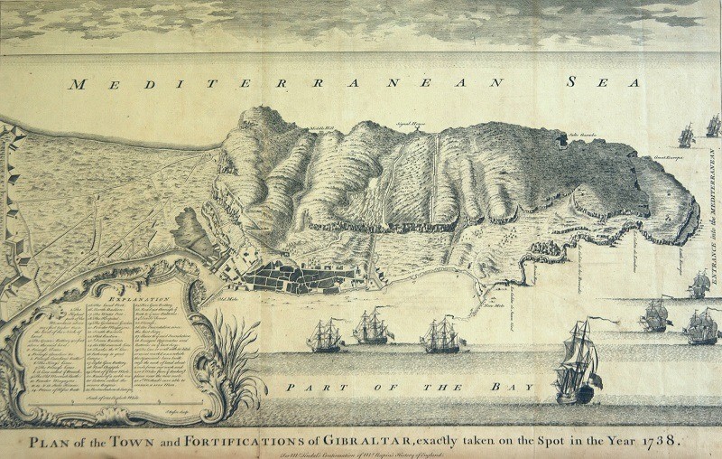
Plan of the town and fortifications of Gibraltar, exactly taken on the spot in the year 1738.

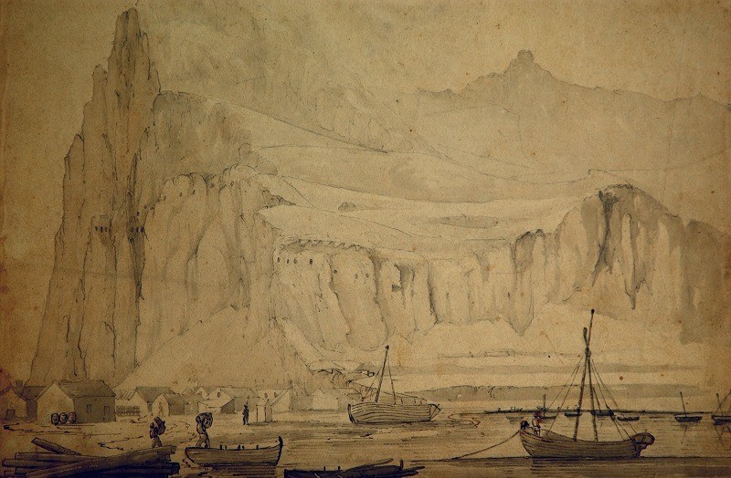
North Front, Gibraltar. 1823-1825. Lieutenant R. J. Stotherd, RE. Watercolour.
The Inundation
Shortly after the Anglo-Dutch storming and capture of Gibraltar in 1704 dramatic changes began to transform the isthmus. The piece of land linking the Rock to the Spanish mainland became the front line for the Spaniards who were attempting to re-take the Rock. Batteries were placed on this ground facing the Rock and the area saw much activity. The British also strengthened their side. The cliffs facing north and west were scarped and one of the larger shallow lakes was dredged and enlarged and given a permanent connection with the Bay of Gibraltar. It came to be known as the Inundation or the Laguna.
The reason for expanding the lake was clearly military. This was the only weak point from which the Rock could be attacked. John White (1772) provides a first-hand description:
“The only narrow pass that Nature has left practicable from the Isthmus is defended by the old Mole, Grand Battery and Moorish Castle in front and by the King’s and Prince’s Lines and Moorish Castle in flank. And to add to the difficulty of approach the space between the Lines and the Bay, which was formerly a kind of swamp or morass is now cleared out and sunk below the level of the high-water mark, and converted into a fine body of water, called the Inundation which is filled occasionally by a sluice from the sea at high tides and confined by a strong dam of masonry. By these means the only entrance left by land is reduced to two very narrow paths, one of which is the Dam of the Inundation, and the other lies between the eastern margin of the Inundation and the foot of the rock, below the lines.”
By the mid-nineteenth century the lake was not without its problems as we hear from Kelaart:
“The lagoon, now turned into a kind of moat, called the ‘inundation’, contains large quantities of sea-weed; the removal of which is almost the constant occupation of several men, as its accumulation rapidly increases, and it is very liable to putrefy, the water in this reservoir being a mix of rain and sea-water.”
In 1998 we excavated a nineteenth century wall by the Forbes’ Barrier. It was in the form of a small pier, which we concluded was, used the transportation of rocks from Forbes’ Quarry to the coast. Within a metre of the surface we found a dark and richly organic soil, the old floor of the marsh which had been dredged to form the Inundation!
Published: June 01, 2020
Other similar Virtual Museum
Other similar VM - Military History
Virtual Museum VM - Historical Notes from our Archive
historical notes from our archive a. e. serfaty
Published: April 04, 2020
18-20 Bomb House Lane
PO Box 939,
Gibraltar
